

Cornwall’s leading drone survey specialists

Our Services
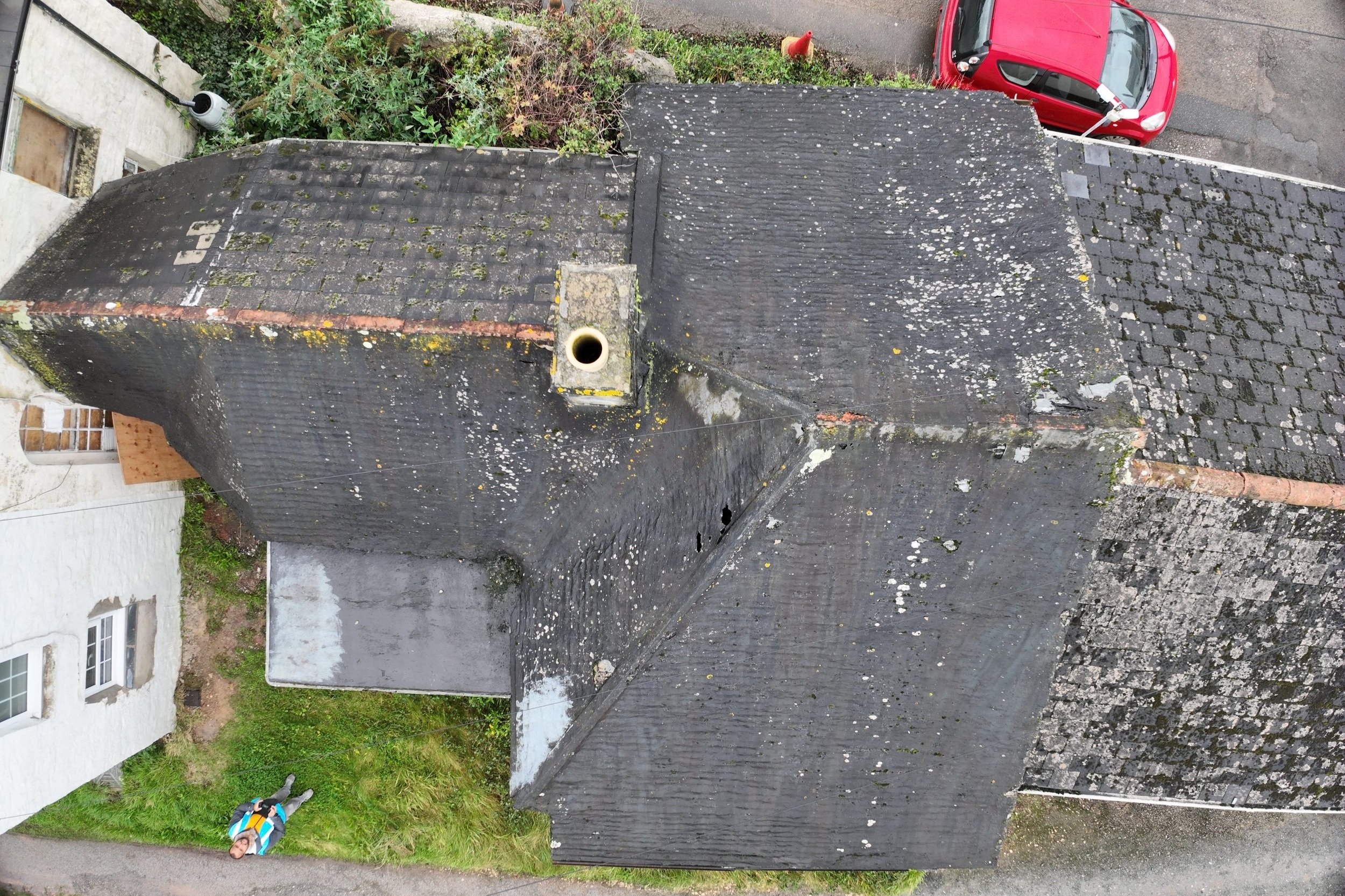
Domestic & Commercial Roof Surveys
A high level drone survey provides peace of mind for property owners and insurers. Buying a new property or looking to make repairs a comprehensive survey can save time and money.

Construction & Surveying Site Surveys
Monitor progress and keep clients up to date with comprehensive and accurate site surveys. Prior to development or during construction a geospatial survey can provide vital information for project management.

Photogrammetry & 3D Modelling
A non invasive or damaging survey can help in preserving listed buildings and national monuments through targeted conservation surveys. A digital twin will enhance future conservation efforts.
Why choose Jak Drones?
We pride ourselves on delivering highly accurate and cost effective data collection for our clients. Drones offer unparalleled flexibility enabling our clients to undertake complex inspections and site surveys without the need for expensive and time consuming preparations.
All Jak Drones pilots hold a full GVC qualification meaning our clients know they are getting a safe, reliable and trusted service even in the most difficult and constrained environments.
-
Drones offer a much faster means of collecting data over large areas. Pre planned flight paths allow us to cover a much larger area compared to conventional survey methods.
-
Using software packages we are able to compile our data into 3D or 2D maps enabling faster and more efficient collaboration across the project.
-
Through aerial inspections we are able to undertake inspections which would otherwise result in expensive and time consuming pre site checks and equipment set up.